









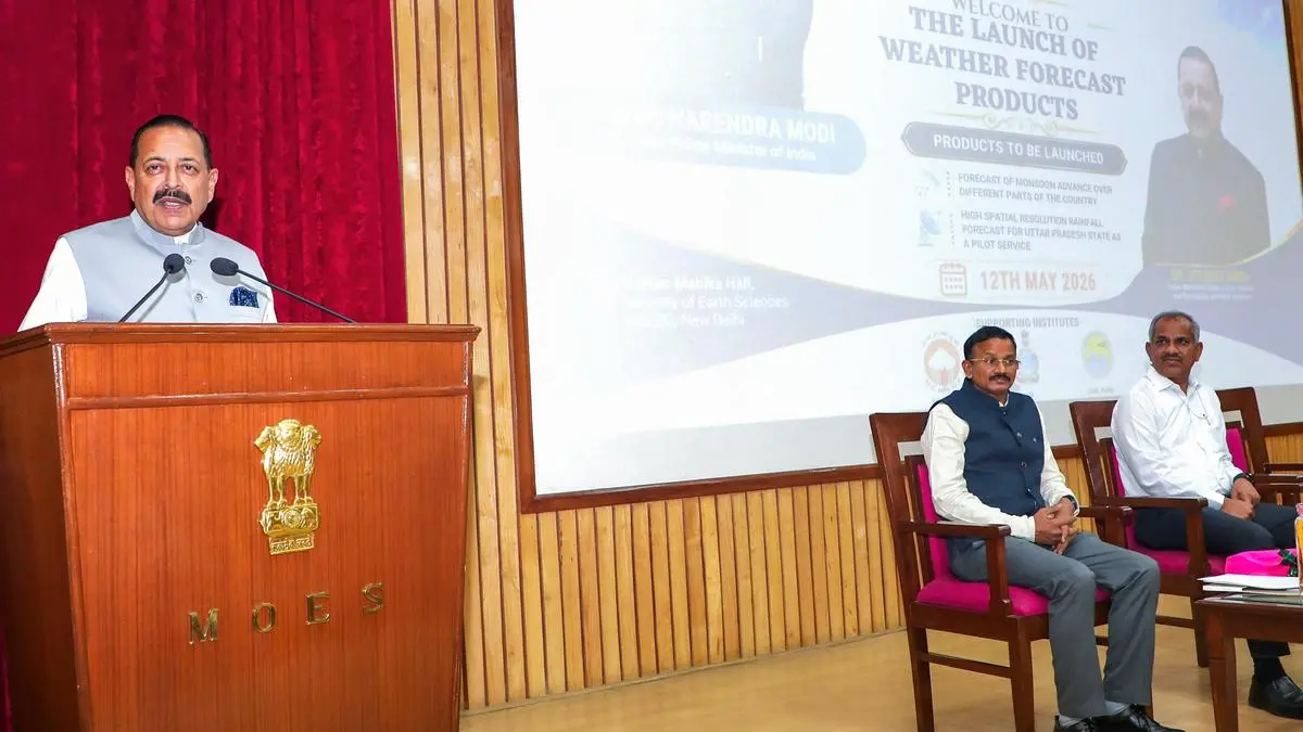
New Delhi, May 12 (ANI): Union Minister of State (Independent Charge) for Science & Technology, Earth Sciences Jitendra Singh addresses during the launch of two advanced weather forecast products developed under the Ministry of Earth Sciences (MoES), in New Delhi on Tuesday. (@DrJitendraSingh X/ANI Photo) | Photo Credit: ANI
India Meteorological Department (IMD) on Tuesday unveiled two forecast products – a pan-India district-level monsoon forecast 10 days in advance and for a geographical area of 1 km in Uttar Pradesh as pilot model. The weather bureau said it has great potential for the agriculture sector.
Launching the two weather forecast products, developed jointly by the IMD, Pune-based Indian Institute of Tropical Meteorology (IITM) and National Centre for Medium Range Weather Forecasting (NCMRWF), Earth Sciences Minister Jitendra Singh said that it marks a major shift from conventional weather (rainfall, temperature, fog, cold, heatwave, cloudburst, etc.) forecasting towards impact-based and decision-support forecasting. It is capable of providing precise, location-specific and actionable information to farmers, administrators, disaster managers and citizens.
Earth Science Secretary M Ravichandran said that the numerical model which IMD was using was not sufficient because various physics approximations involved. “It is not suitable to go for such a high resolution (from 12.5 km to 1 km), and also the computational requirements are very high. So, it was difficult,” he said, referring to the numerical model.
“With the help of IITM and NCMRWF and IMD, fusion of both numerical model and also the data-driven training model can have a better forecast at different timescales. These particular two products, using first ever Artificial Intelligence (AI) driven system, are user-driven and the agriculture ministry needed this information very badly,” said Ravichandran.
On the pilot project, he said data are most crucial and Uttar Pradesh has over 500 weather stations and 2,400 automatic rain gauges (ARGs). If other states too set up such infrastructure it is possible to cover entire country over the next 2-3 years with such highly localised forecast, Ravichandran said.
On the forecast of monsoon advance over different parts of the country, he said people can feel they are ready to receive the rainfall. “Earlier, we used to give only the onset of the monsoon in the southern tip of India (Kerala coast) and it slowly progresses in different states. Now, we are going to give a granular scale, even at the district level, when the monsoon will be on,” he said, adding for the first time IMD would be able to do this which was so far provided by some of the international agencies.
“With all the resources available, we have put in together with the pilot experiments in the monsoon weather scale. I am sure that it is an evolutionary process. Maybe next year we have more and more observations and more states to come up,” he said.
The minister said that India had 16-17 Doppler Weather Radars a decade ago, which has now increased to around 50, and another 50 planned under Mission Mausam. He said this expansion of observational networks, automatic weather stations, high-performance computing systems and digital dissemination platforms has substantially improved forecasting capability and early warning systems across the country.
He said the High Spatial Resolution Rainfall Forecast for Uttar Pradesh, has been developed as a pilot service to generate rainfall forecasts at 1-km spatial resolution up to 10 days in advance. The system uses advanced AI-driven downscaling techniques and integrates data from ARGs, Automatic Weather Stations (AWSs), Doppler Weather Radars and satellite-based rainfall datasets.
Published on May 12, 2026
此内容由惯性聚合(RSS阅读器)自动聚合整理,仅供阅读参考。 原文来自 — 版权归原作者所有。