









Leading edge of an cooler western disturbance has crossed into India, manifesting as a cyclonic circulation over north Pakistan and adjoining parts of Kashmir on Thursday morning. A successor disturbance is likely to affect the hills of North-West India from Saturday, India Meteorological Department (IMD) said.
A parent upper-air trough passed this (Thursday) morning through Amritsar; Mudki; and Bathinda in Punjab. The disturbance has triggered a cyclonic circulation over Punjab, from which a trough extended southward into south-west Rajasthan. An additional upper-air cyclonic circulation is active over north-east Rajasthan.
Lid on mercury
The constellation of weather systems is likely continue to put a lid on mercury and usher in a spell of pre-monsoon weather marked by rain; thunderstorms; occasional lightning; and possibility of hail in isolated areas. Meanwhile, the robust anti-cyclonic circulation responsible for the scorching summer conditions continued to dominate interior Maharashtra and neighbouring Telangana.
A couple of helpful troughs of low-pressure lying elsewhere will help transmit the tolerable weather to other parts of the country. A trough ran across from north-east Madhya Pradesh to a cyclonic circulation over north-east Bangladesh caressing Jharkhand and plains of West Bengal. A trough/wind discontinuity extended North Interior Karnataka to Gulf of Mannar cutting across South Interior Karnataka and Tamil Nadu.
Rain, thundershowers
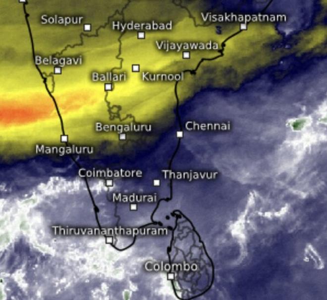
Wet weather and clouds holds over South Peninsula back hot and dry air (golden yellow) to Central India on Thursday morning. | Photo Credit: www.meteologix.com/in
Rain or thundershowers occurred at most places over Himachal Pradesh; West Uttar Pradesh; Jharkhand; hills and plains of West Bengal and Sikkim; Jammu and Kashmir and Ladakh; East Uttar Pradesh; and at many places over West Rajasthan; West Madhya Pradesh; East Madhya Pradesh; East Rajasthan; Odisha; Chhattisgarh; Coastal Andhra Pradesh and Yanam until 5.30 am this morning.
Bengaluru bore the brunt as it lay directly in the path of a trough/wind discontinuity, recording heavy rainfall accompanied by hail, with 11 cm falling in a short span. Rain or thundershowers also occurred at many places across South Interior Karnataka; Bihar; Assam; Meghalaya; and the north-eastern states of Nagaland, Manipur, Mizoram, and Tripura; as well as in Kerala and Mahe; Tamil Nadu, Puducherry and Karaikal; and Lakshadweep.
Australia season ends
Meanwhile, the wet season across northern Australia is likely drawing to to a close around its usual time, removing a potential obstacle to the timely onset and progression of the south-west monsoon over the Maldives, Sri Lanka, and India.
The Australian monsoon, which typically runs from October 1 to April 30, this year delivered approximately 680 mm of rainfall in northern Australia between October 1 and April 20, about 42 per cent above the long-term 1961–1990 average. With transition to dry season now underway, the Australian Bureau of Meteorology has forecast relatively little rainfall across most of northern Australia during the fortnight from May 2 to 15.
Published on April 30, 2026