





Our warming world is set to enter an El Niño period as early as May, with a high likelihood of southern North America experiencing supercharged temperatures.
One of the three phases of the natural El Niño-Southern Oscillation (ENSO) cycle in the Pacific Ocean, El Niño events occur every two to seven years, driving up sea surface temperatures across the Pacific Ocean and increasing global temperature. The last El Niño partially explains why 2024 was the hottest year on record.
The knock-on effects of past El Niño events have been profound, with studies linking them to famine in Europe; civil wars in tropical regions; and droughts, floods and forest fires around the world.
And there's a good chance this year's El Niño will be particularly intense, with current forecasts indicating a 25% chance that El Niño will be "very strong" by November — meaning sea surface temperatures will rise by 3.6 degrees Fahrenheit (2 degrees Celsius) above average.
To get a better idea of what the upcoming El Niño will look like and what it could mean for Earth's climate and weather, Live Science spoke with Nathaniel Johnson, a research meteorologist and member of the ENSO seasonal forecast team at the National Oceanic and Atmospheric Administration's (NOAA) Climate Prediction Center. Here's what he had to say.

Johnson's research focuses on climate dynamics, with particular interests in subseasonal-to-seasonal climate variability and predictability, climate prediction, tropical-extratropical interaction, and atmospheric teleconnection patterns
Sophie Berdugo: How does NOAA predict and classify El Niño?
Nathaniel Johnson: Our basic classification of El Niño is based on the relative sea surface temperatures in this Eastern Central equatorial Pacific. And by relative, it means relative to the tropical average. So, when the East Central tropical Pacific sea surface temperatures are more than 0.5 C [0.9 degrees Fahrenheit] above the tropical average, then we have El Niño conditions.
We can further subdivide El Niño into weak, moderate and strong. So that's more of an unofficial subdivision just based on how warm the ocean surface is in the east central tropical Pacific.
SB: What are the thresholds for those unofficial subdivisions, and how rare is each category?
NJ: El Niño is declared when the Relative Oceanic Niño Index — that's a measure of the ocean temperatures in the east central tropical Pacific box — is more than 0.5 C above the tropical average.
So between 0.5 C and 1 C [1.8 F], that would be a weak El Niño. El Niño, on average, occurs about every three to four years. Many times, it's a weak El Niño. If this index is between 1 C and 1.5 C [2.7°F], then we say it's a moderate event.
If it's 1.5 C to 2 C, we consider it a strong event. And then above 2 C is a very strong event. A very strong event is the sort of event that happens maybe once every 10 to 20 years.
What is the current forecast for the upcoming El Niño, and how certain is it?
NJ: Currently, NOAA predicts about a 90% chance that El Niño will develop by this fall. Usually, it's more difficult to make a forecast for El Niño in the spring: we have a so-called spring predictability barrier where forecasts tend to be less confident in the spring. So the fact that NOAA predicts a 90% chance is unusual for this time of year.
And there's about a 50% chance that it will at least be a strong event — (so, again, that index above 1.5°C — and about a 25% chance that'll be a very strong event, so above that 2°C.
There's still a lot of uncertainty about how strong this event will be. But I'd say it's still unusually confident that we will have an El Niño given that, this time of year, it's often difficult to be very precise about our El Niño forecast.

2023's El Niño event played a role in 96% of oceans worldwide experiencing extreme heatwaves that year.
(Image credit: Zhenzhong Zeng)
SB: Why is it tricky to forecast this time of year? And what does the fact that we've already got quite a high certainty that it's coming mean for this impending El Niño?
NJ: El Niño requires cooperation between the atmosphere and the ocean, so there has to be certain feedbacks between the tropical atmosphere and ocean. And coupling between the ocean and atmosphere is weaker this time of year, just because of seasonal changes in the average sea surface temperature.
So, for example, there's less of an east-west contrast between the Western Pacific and the Eastern Pacific. And that contrast between the East and West is what's important for this coupling between the tropical atmosphere and ocean.
So what that means is that it's easier to disrupt the development of an El Niño by just chaotic weather. So things that we cannot predict more than a few weeks in advance, for example, if we suddenly had strong winds coming from the East to West, that could help disrupt an El Niño.
The fact that we're this confident that El Niño will develop just tells us that, despite these uncertainties, despite the compounding impacts of the chaotic weather, the conditions are really well aligned for this El Niño to develop. We haven't seen anything, any signs that this progression is being disrupted. Everything so far seems to be aligning with this rapid change from the La Niña conditions we had last boreal winter [winter in the Northern Hemisphere]. We're now neutral, but the Eastern Pacific is warming up pretty quickly right now.
It might be one of the most rapid transitions that I've seen in the record — maybe the most rapid.
SB: Is it unusual how rapidly we've got this new El Niño approaching?
NJ: Yes, it is actually pretty unusual. The other way around is not so unusual. It's actually pretty common to go from, say we have a strong El Niño, to rapidly transition to a La Niña. But the other way around, going from a weak to almost moderate La Niña into El Niño and potentially a strong El Niño, that is more rare.
And, in fact, if this does turn out to be a very strong El Niño, it might be one of the most rapid transitions that I've seen in the record — maybe the most rapid. Because, to go from a weak-to-moderate La Niña to a strong-to-very-strong El Niño within one calendar year is just not something we see very often.
SB: So what could be causing that?
NJ: It's something that's going to have to be diagnosed after the event if it does turn out that way.
I'll just note that over the past century, we have seen an increase in these more rapid swings from one state to the other. So there's some suggestion that potentially climate change could play a role in making these swings more rapid between El Niño and La Niña. It's something that will take more investigation.
SB: What impact could a very strong El Niño event have on climate and food systems this year?
NJ: If we did have a very strong El Niño, it would have, for example, impacts on our fisheries. If we had a very strong El Niño, we could have a collapse of the Eastern equatorial Pacific "cold tongue," so that would reduce the amount of nutrient-rich water that gets upwelled. [Editor's note: The Eastern equatorial Pacific "cold tongue" is a nutrient-rich body of surface water in the Pacific Ocean.]
That would have potentially a very significant negative impact on, say, anchovy fisheries in Peru. We tend to see a migration of warm-water fish to warmer waters, like tropical fish migrating northward or to the West Coast of North America. Maybe cold-water species may see a decline of fish like salmon.
We see, potentially, negative impacts on crops where there's drought, so places like from Indonesia to Australia to northern South America tend to have drought. Those are some of the big impacts on food.
The wildfire risk would be increased over places including Australia, Indonesia, northern Brazil, parts of maybe western Canada and northern U.S., where the conditions are expected to be drier.
A very strong event just generally means much warmer tropical waters in general. So, coral bleaching could potentially be quite severe. So it's a lot of potentially strong ecological impacts from a very strong event.
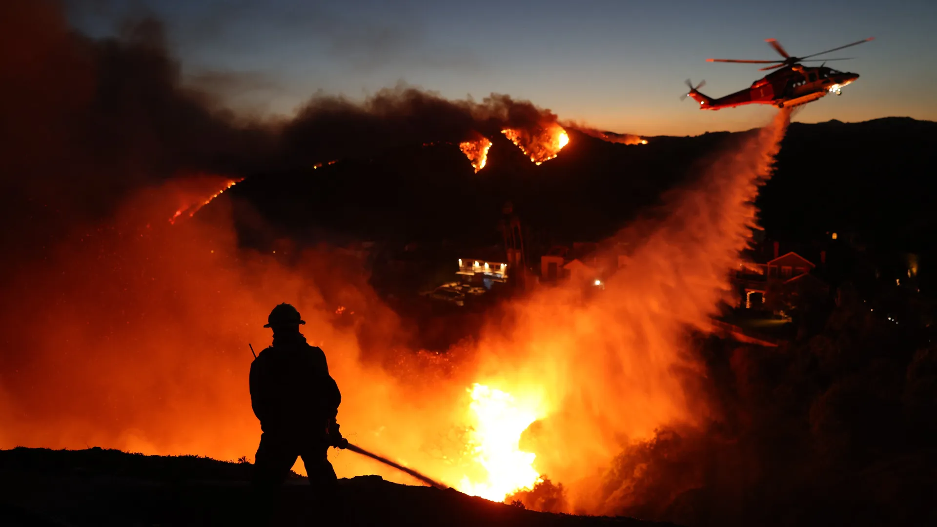
Firefighters respond to wildfires in the Pacific Palisades, California, on January 7, 2025.
(Image credit: David Swanson/AFP via Getty Images)
SB: The most recent El Niño lasted from 2023 to 2024, and 2024 became the hottest year on record. What can we expect in terms of global temperatures for this upcoming El Niño?
NJ: El Niños tend to bring a temporary spike in the global mean temperature. If it turns out to be a strong event, then that would tend to be an even bigger spike on top of the long-term warming trends. So, if we were to have a stronger El Niño, then it would just increase the likelihood that we could have a new record in global mean temperatures.
SB: What will the impacts be on the U.S., parts of which are already facing severe drought conditions even before summer?
NJ: The impacts on the U.S. would tend to be strongest in our winter, although beforehand, the first notable impact would be on the hurricane season. Typically, during El Niño, we see a suppression of the Atlantic hurricane season and an enhancement of the Eastern Pacific season — so overall, maybe a reduced risk of tropical cyclones in the summer and fall.
But then, typically in the winter, we see enhanced rainfall and snowfall over the Southern tier of the U.S. So that would be potentially good news for the drought-stricken regions of the Southern part of the U.S.
But that shift to the storm track south would mean that drought in the more Northern areas may persist. So it would enhance the probability of persisting drought over the Northern parts that have been affected.
SB: So could El Niño bringing heightened winter rainfall to drought-stricken Southern parts of the U.S. lead to a greater risk of flooding?
NJ: Drought relief obviously would be great, but there is a potential heightened risk of floods. Particularly if we have a strong to very strong event, what we see is that the subtropical jet stream gets extended more to the East, more towards the North American continent. That could lead to more frequent, say, atmospheric rivers over parts of the West Coast — places like California.
And those atmospheric rivers, of course, bring beneficial rain and snowfall — you know, snowpack to the Midwest — but they also bring flooding and destruction from winds. And so there's always both positives and negatives that they can potentially counterbalance each other.
SB: What should people and governments do to prepare?
NJ: I think, at this point, they [should] just prepare for the enhanced risks that are associated with an El Niño of various strengths — understanding that there's still uncertainty in terms of the amplitude, as I mentioned, but there is a potential for a strong to very strong event. All these risks that are associated with El Niño, just be prepared to devote the resources necessary to address those risks.
Again, it's not certain — there's always other factors — but the stronger the event, the more likely it is that this El Niño is going to dominate over the other factors that could be influencing our weather and climate.
SB: There's been a lot of talk about there being a "super" El Niño and what the potential impacts will be. What is your closing message to readers?
NJ: I guess my message would be to try to filter out the hype and just focus on the solid science. Have a rational viewpoint of the forecast, which is, an El Niño is likely; there's still uncertainty in terms of how strong it will be. Just be aware of the potential impacts that may come, and note that we're going to continue to fine-tune the forecast in the months ahead.
Editor's note: This interview has been condensed and edited for clarity.