












On August 10, 2025, a massive geological event reshaped the Tracy Arm fjord in Alaska, triggered by the retreat of the South Sawyer Glacier.
A study published in Science (May 2026) detailed the scale and impact of this disaster.
Approximately 64 million cubic meters of rock collapsed into the fjord, generating a seismic signal equivalent to a 5.4-magnitude earthquake.
The resulting tsunami was nothing short of apocalyptic. At its peak, the wave surged to a staggering 1,578 feet (481 meters) above sea level.
“The bright landslide scar on the north side of the fjord is striking, as is the ‘bathtub’ ring around the fjord showing the areas where the forest was leveled by the tsunami,” said Dan Shugar, a geomorphologist at the University of Calgary.
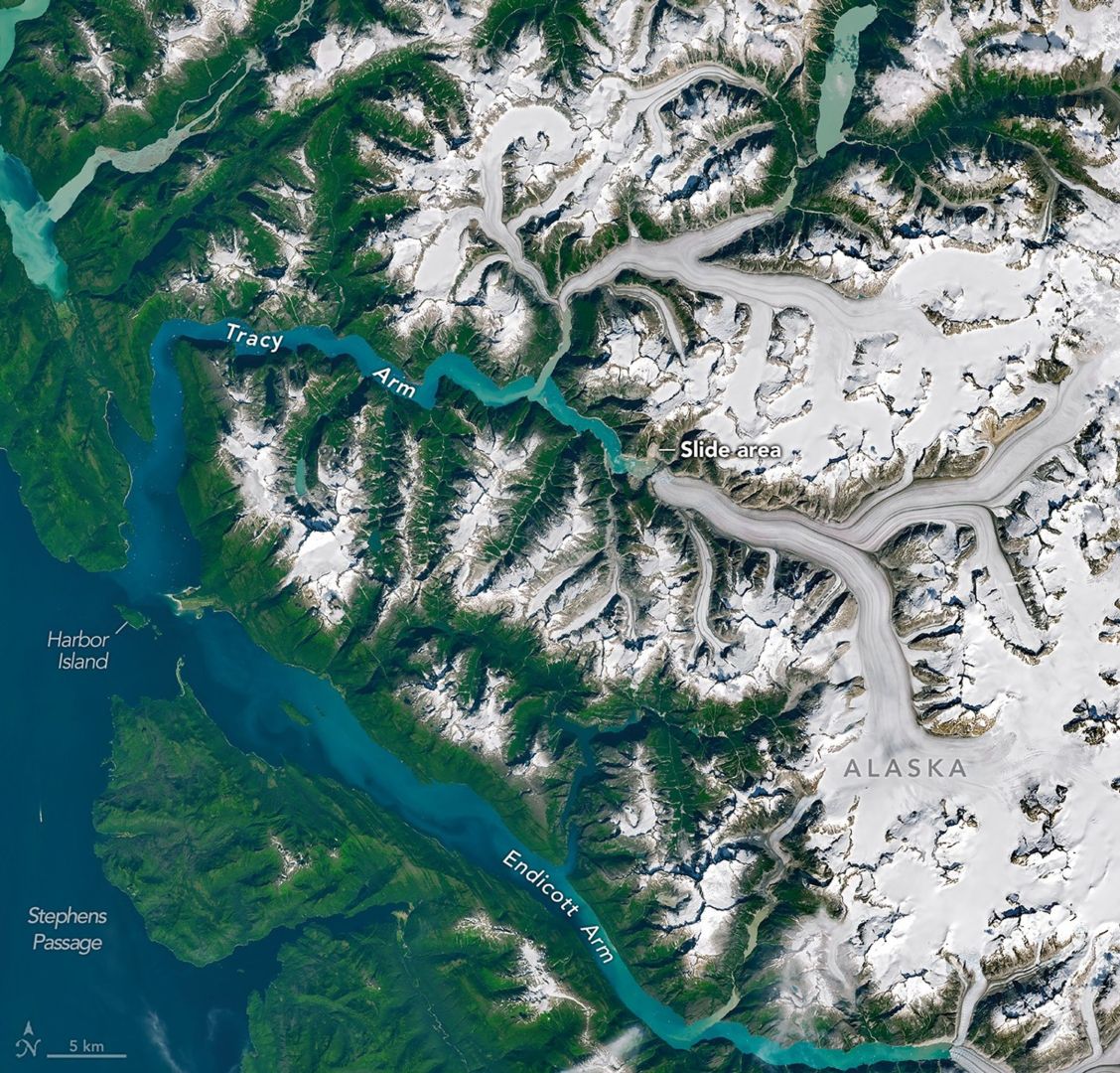
According to this study, the culprit is the climate. Geomorphologist Dan Shugar and his team used NASA-USGS Landsat satellites to pin the disaster on the rapid retreat of the South Sawyer Glacier.
The team analyzed images from July and August 2025, revealing a prominent landslide scar and a “bathtub ring” of leveled forest where the tsunami stripped the landscape.
The event’s power was further evidenced by Sawyer Island, located 9 kilometers (6 miles) away. It was transformed from lush green to barren brown as the surge decimated almost all vegetation, leaving only the highest elevations untouched.
The water didn’t just rise and fall; it sloshed. The landslide triggered a “seiche,” a phenomenon where water oscillates back and forth like a giant bathtub. In Tracy Arm, this rhythmic surging continued for over 24 hours.
According to NASA, these events generated seismic signals detectable across some parts of the globe.
Some melting occurred naturally, but the landslide’s force physically severed a massive section of the glacier’s terminus, filling the fjord with a dense slurry of icebergs.
At present, the precise cause of the landslide remains unconfirmed. It likely resulted from a combination of moderate rainfall and slope destabilization from rapid glacial melting.
This retreat proved critical, as it created a newly exposed body of open water that directly enabled the landslide to trigger a massive, landscape-altering tsunami.
While the event miraculously claimed no lives, the close calls were harrowing. Kayakers on Harbor Island watched as their entire campsite was swallowed by the tide.
Nearby, cruise ship passengers in Endicott Arm felt the ocean breathe, reporting sudden, violent currents and dramatic shifts in water levels that signaled something had gone terribly wrong deep in the wilderness.
This disaster serves as a grim preview of a warming North.
Brentwood Higman of Ground Truth Alaska emphasizes that we are entering an era of landscape reorganization.
“A glacier’s shift from relative stability to renewed retreat, visible in satellite images, could serve as an important indicator that an area has become more susceptible to landslide and tsunami hazards,” the press statement stated.
As the climate warms, the world’s most breathtaking landscapes are becoming its most fragile.

Get the latest in engineering, tech, space & science - delivered daily to your inbox.
Mrigakshi is a science journalist who enjoys writing about space exploration, biology, and technological innovations. Her work has been featured in well-known publications including Nature India, Supercluster, The Weather Channel and Astronomy magazine. If you have pitches in mind, please do not hesitate to email her.
此内容由惯性聚合(RSS阅读器)自动聚合整理,仅供阅读参考。 原文来自 — 版权归原作者所有。