惯性聚合 高效追踪和阅读你感兴趣的博客、新闻、科技资讯
阅读原文 在惯性聚合中打开

推荐订阅源

C
CXSECURITY Database RSS Feed - CXSecurity.com
K
Kaspersky official blog
A
Arctic Wolf
Attack and Defense Labs
L
LINUX DO - 热门话题
N
News | PayPal Newsroom
cs.CV updates on arXiv.org
L
Lohrmann on Cybersecurity
PCI Perspectives
PCI Perspectives
cs.AI updates on arXiv.org
The Last Watchdog
The Last Watchdog
B
Blog RSS Feed
让小产品的独立变现更简单 - ezindie.com
W
WeLiveSecurity
Know Your Adversary
Know Your Adversary
博客园 - Franky
T
Tenable Blog
T
Tailwind CSS Blog
钛媒体:引领未来商业与生活新知
钛媒体:引领未来商业与生活新知
Help Net Security
Help Net Security
WordPress大学
WordPress大学
T
The Exploit Database - CXSecurity.com
www.infosecurity-magazine.com
博客园 - 司徒正美
阮一峰的网络日志
阮一峰的网络日志
D
Darknet – Hacking Tools, Hacker News & Cyber Security
H
Heimdal Security Blog
TaoSecurity Blog
TaoSecurity Blog
S
Security Affairs
J
Java Code Geeks
小众软件
小众软件
freeCodeCamp Programming Tutorials: Python, JavaScript, Git & More
Apple Machine Learning Research
NISL@THU
NISL@THU
O
OpenAI News
The Cloudflare Blog
月光博客
月光博客
Google Online Security Blog
V
V2EX
罗磊的独立博客
美团技术团队
博客园 - 三生石上(FineUI控件)
Security Latest
Security Latest
奇客Solidot–传递最新科技情报
奇客Solidot–传递最新科技情报
C
Cyber Attacks, Cyber Crime and Cyber Security
cs.CL updates on arXiv.org
Cyberwarzone
Cyberwarzone
L
LINUX DO - 最新话题
Hacker News - Newest:
Hacker News - Newest: "LLM"
大猫的无限游戏
大猫的无限游戏

Steve Bennett blogs

Whenever: exploring times and places in film and books Alternative Earth: a procedurally generated map using vector tiles Host your own vector tile server on Glitch Building TinyMap: an itty bitty collaborative mapping tool You might not need PostGIS: streamlined vector tile processing for big map visualisations OpenStreetMap vector tiles: mixing and matching engines, schemas and styles 2015’s proudest moments Your own personal National Map with TerriaJS: no coding and nothing to deploy After the hackathon: 4 classic recipes OpenTrees.org: how to aggregate 373,000 trees from 9 open data sources Cycletour.org: a better map for Australian cycle tours Normalize cross-tabs for Tableau: a free Google Sheets tool 7 reasons to release that government dataset The Data Guru in Residence Chromecast in the real world: six casting workflows Multivariate binary symbol maps with TileMill. The Australian’s menacing editorial Cycletouring and OpenStreetMapping: a beautiful symbiosis Git: what they didn’t tell you One week of Salt: frustrations and reflections. Super lightweight map websites with Github Digital humanities for beginners: get started with the Trove API Trello Tennis Terrain in TileMill: a walkthrough for non-GIS types A TileMill server with all the trimmings Forget trying to remember your servers’ names! Anonymous longitudinal surveys with LimeSurvey Windows red cross errors scam What I learned at e-Research Australasia 2012 A pattern for multi-instrument data harvesting with MyTardis Getting started with Chef on the NeCTAR Research Cloud How OData will solve data sharing and reuse for e-Research 10 things I hate about Git Semantic Google keywords Improving on the “administration rights required” workflow Why is buying stuff from eBay so complicated? Introducing: Cooking for engineers New Gmail feature: auto mailing list management Penny Auctions – a bit of analysis Hello world!
Web map projections: the bare minimum you need to know
steveko · 2014-07-25 · via Steve Bennett blogs

Posted by on July 25, 2014

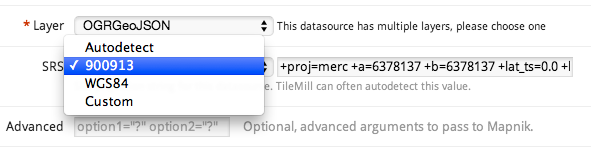
TileMill wants to know: what projection is this data?

TileMill wants to know: what projection is this data?

If you’re making maps, you will probably need to know something about cartographic projections. Here’s the minimum.

  1. The globe is round, maps are flat. Each of the hundreds of different methods for converting from round to flat is a projection.
  2. When you have a latitude and longitude, you have unprojected coordinates. Anything you can do with these doesn’t require choosing a projection.
  3. Most consumer web maps use the Web Mercator projection, also known as the Google Web Map de facto standard, EPSG:900913 (“google” written with numbers), EPSG:3857, etc.
  4. Government agencies, desktop apps and other stuff often use the WGS84 projection, also known as EPSG:4326.
  5. It is technically straightforward to convert from unprojected coordinates to any projection, or between projections, using GIS packages or command line tools like GDAL. It can be slow to do this on the fly.
  6. Each projection is defined using a Spatial Reference System. An SRS can also define systems of unprojected coordinates, and even other planets.
  7. There are half a dozen common formats for describing the SRS, including:
    1. SRID, an identifier including the identifier scheme, like “EPSG:3857”, “ESRI:102113” or “SR-ORG:7483”.
    2. proj4, a short piece of text with lots of + and =, used by a tools like GDAL and TileMill. It looks like:
      +proj=longlat +ellps=WGS84 +datum=WGS84 +no_defs 
    3. Well-known text (WKT), a verbose format that can also be used to define spatial data. For example:
      GEOGCS[“GCS_Oman”,
      DATUM[“Oman”,
      SPHEROID[“Clarke_1880_RGS”,6378249.145,293.465]],
      PRIMEM[“Greenwich”,0],
      UNIT[“Degree”,0.017453292519943295],
      AUTHORITY[“EPSG”,”37206″]]
  8. The tool you are working with (eg, TileMill) will only support certain projections. You need to:
    1. Find data that is in the right projection (Web Mercator is the safest), or convert it; and
    2. Tell the tool what projection it’s in, if it can’t guess. You will have to pick from a list, or use one of the formats above, that it supports.