
惯性聚合 高效追踪和阅读你感兴趣的博客、新闻、科技资讯
阅读原文 在惯性聚合中打开

推荐订阅源

P
Proofpoint News Feed
V
Visual Studio Blog
freeCodeCamp Programming Tutorials: Python, JavaScript, Git & More
T
Threatpost
TaoSecurity Blog
TaoSecurity Blog
Engineering at Meta
Engineering at Meta
T
Troy Hunt's Blog
Exploit-DB.com RSS Feed
H
Heimdal Security Blog
Webroot Blog
Webroot Blog
A
About on SuperTechFans
S
Securelist
Recorded Future
Recorded Future
K
KPMG report finds enterprise disconnect between AI and its ROI | CIO
阮一峰的网络日志
阮一峰的网络日志
S
SegmentFault 最新的问题
P
Palo Alto Networks Blog
F
Fortinet All Blogs
Hacker News: Ask HN
Hacker News: Ask HN
WordPress大学
WordPress大学
W
WeLiveSecurity
N
Netflix TechBlog - Medium
博客园 - 叶小钗
宝玉的分享
宝玉的分享
大猫的无限游戏
大猫的无限游戏
G
GRAHAM CLULEY
Schneier on Security
博客园 - 聂微东
www.infosecurity-magazine.com
小众软件
小众软件
博客园 - 【当耐特】
有赞技术团队
有赞技术团队
cs.CV updates on arXiv.org
A
Arctic Wolf
C
CXSECURITY Database RSS Feed - CXSecurity.com
Google DeepMind News
Security Latest
Security Latest
cs.AI updates on arXiv.org
T
Threat Research - Cisco Blogs
奇客Solidot–传递最新科技情报
奇客Solidot–传递最新科技情报
Spread Privacy
Spread Privacy
罗磊的独立博客
The Hacker News
The Hacker News
钛媒体:引领未来商业与生活新知
钛媒体:引领未来商业与生活新知
IT之家
IT之家
B
Blog
GbyAI
GbyAI
Hugging Face - Blog
Hugging Face - Blog
Google Online Security Blog
MongoDB | Blog
MongoDB | Blog

Steve Bennett blogs

Whenever: exploring times and places in film and books Alternative Earth: a procedurally generated map using vector tiles Host your own vector tile server on Glitch Building TinyMap: an itty bitty collaborative mapping tool You might not need PostGIS: streamlined vector tile processing for big map visualisations OpenStreetMap vector tiles: mixing and matching engines, schemas and styles 2015’s proudest moments Your own personal National Map with TerriaJS: no coding and nothing to deploy After the hackathon: 4 classic recipes OpenTrees.org: how to aggregate 373,000 trees from 9 open data sources Cycletour.org: a better map for Australian cycle tours Normalize cross-tabs for Tableau: a free Google Sheets tool The Data Guru in Residence Chromecast in the real world: six casting workflows Web map projections: the bare minimum you need to know Multivariate binary symbol maps with TileMill. The Australian’s menacing editorial Cycletouring and OpenStreetMapping: a beautiful symbiosis Git: what they didn’t tell you One week of Salt: frustrations and reflections. Super lightweight map websites with Github Digital humanities for beginners: get started with the Trove API Trello Tennis Terrain in TileMill: a walkthrough for non-GIS types A TileMill server with all the trimmings Forget trying to remember your servers’ names! Anonymous longitudinal surveys with LimeSurvey Windows red cross errors scam What I learned at e-Research Australasia 2012 A pattern for multi-instrument data harvesting with MyTardis Getting started with Chef on the NeCTAR Research Cloud How OData will solve data sharing and reuse for e-Research 10 things I hate about Git Semantic Google keywords Improving on the “administration rights required” workflow Why is buying stuff from eBay so complicated? Introducing: Cooking for engineers New Gmail feature: auto mailing list management Penny Auctions – a bit of analysis Hello world!
7 reasons to release that government dataset
steveko · 2014-09-04 · via Steve Bennett blogs

Posted by on September 4, 2014

As a data guru in residence, I’m helping government bodies prioritise which datasets to release as open data. Sometimes people say “No one would ever find this data interesting, so why bother releasing it?” I think there are several distinct reasons why a given dataset might be worth releasing. Some datasets are valuable for several reasons simultaneously. Some aren’t valuable at all.

When a public servant comments that a potential dataset isn’t interesting or useful, ask: “are there other reasons to release it”?

But if a dataset fails to meet any of these criteria? You have my permission not to release it.
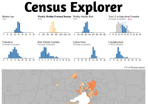
#1 Build an app around it

Census Explorer, by Yuri Feldman, allows easy exploration of part of the 2011 Australian Census.

Census Explorer, by Yuri Feldman, allows easy exploration of part of the 2011 Australian Census.

Datasets like public transport timetables, public bike share station status, or parking space availability are obvious candidates for third party developers to use to build an app. Unfortunately, these examples also require near-realtime feeds in order to be useful.

#2 Support other apps

Even if a dataset isn’t interesting or useful enough to warrant an app in its own right, it could add value to another website or app if it’s easy to use. I’ve come across many of these:
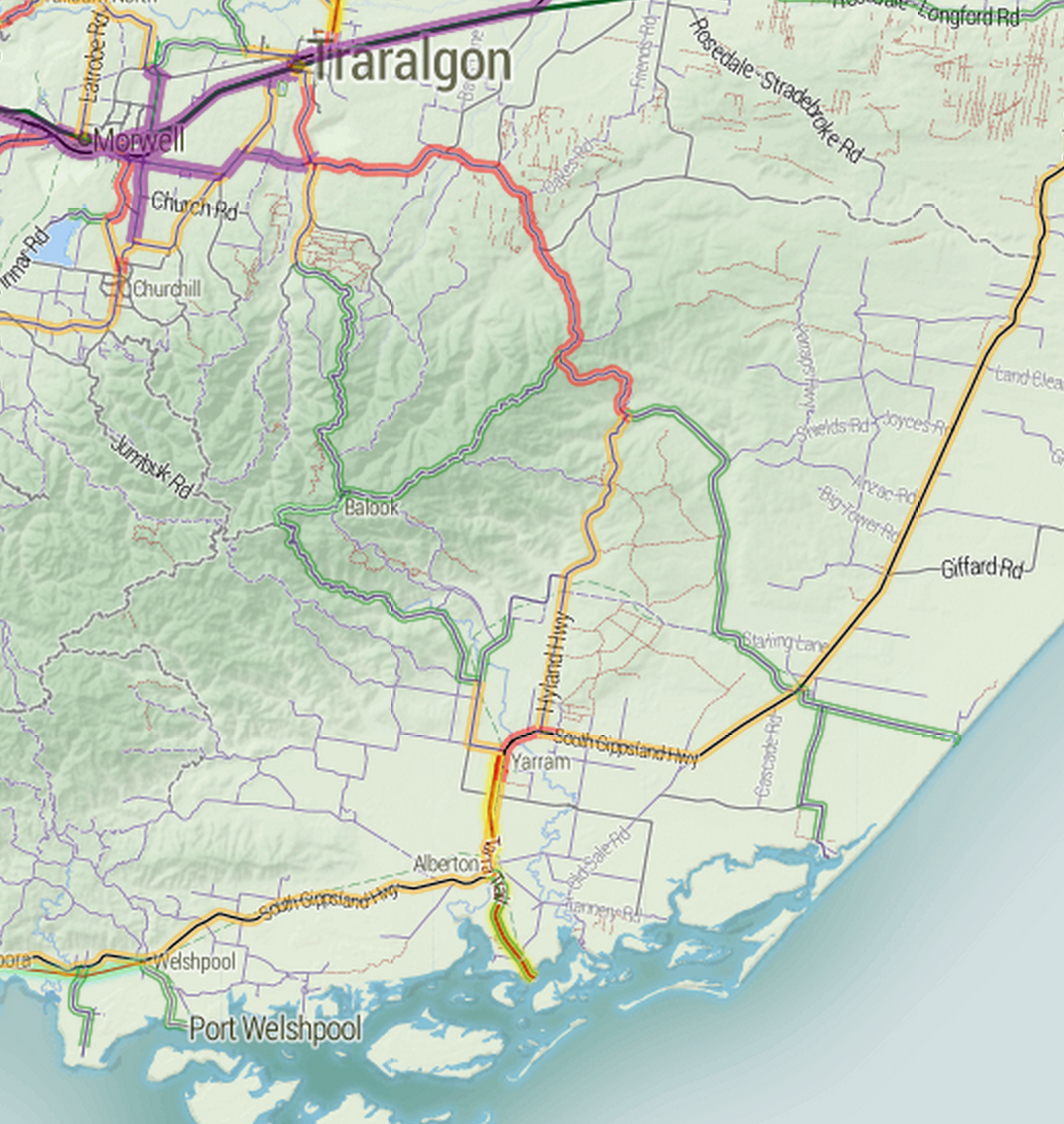
  • Average traffic volume on roads maintained by VicRoads, used to help cyclists decide which roads to avoid, on cycletour.org.
  • The slope of footpaths around Melbourne can help wheelchair users navigate the city.
  • The location and species of every tree in Melbourne can add colour and interest to a map of the city.
  • Locations of drinking fountains could be useful for cycling, jogging, or dog walking apps or websites.

Vicroads traffic volume

Which way would you cycle to Port Albert?

#3 Interesting for research

If a dataset is big, rich, detailed and high quality, then there’s a pretty good chance it’s worth of some kind of analysis. If it’s unique enough, then it might even interest a researcher in starting a research project just to look at this dataset.

Examples: building permits database, public transport timetables (for urban planning).

#4 Supporting other research

Much more common than such a rich dataset is small datasets that researchers find useful to solve particular problems, add context, or strengthen an analysis. Local Government Area boundaries aren’t inherently interesting, but they’re one of the geospatial datasets that researchers request the most often. The ATO’s Standard Business Rules taxonomy sounds incredibly dry to me, but is of potential use to lots of people trying to glue different kinds of data and applications together.

#5 Policy and analysis

Lots of organisations need government data to develop internal strategies or policies to be shared with the public – or even to influence government. Typically they get the data either by transcribing tables from official reports, or by developing direct relationships with the government body in question. Publishing data directly to an open data portal allows a wider range of groups to make use of it, without the overhead of having to ask whether the data is available. Data that is collected regularly, in the same format is a particularly likely to be useful.

#6 Transparency

If the data relates to how government decisions are made, it may be worth releasing to demonstrate transparency – regardless of how much the dataset is even used. For example, releasing annual budget data as an easy to use spreadsheet makes a big political statement about willingness to be scrutinised. Even if no citizen takes up the opportunity to crunch the numbers, they may still appreciate having that option.

Examples: annual budgets, revenue sources (parking meters, speeding fines), parliamentary voting records.

#7 Insights for government

If you’re really lucky, the dataset you publish may help another part of government do something useful. I think good things happen when people can access data without having to ask anyone for it, and the some goes for governments themselves. You can’t really expect insights, but if it happens – great.