







1 Min Read
Credits: NASA Goddard Space Flight Center / Kel Elkins
Kate Ramsayer
Apr 21, 2026
Article
NASA’s photos of Earth released during Artemis II's mission around the moon show our planet against the dark backdrop of space. Auroras illuminated the thin atmosphere, city lights dotted the outline of continents, and brown deserts gave way to green vegetation.
Are those city lights normally this bright? What kind of clouds are swirling over the Atlantic Ocean? Is that hazy brown bit dust, or smoke, or something else?
To dig into the mysteries of our planet Earth, NASA has a fleet of satellites in orbit, gathering data around the clock. Join one of these satellites — the Plankton, Aerosol, Cloud, ocean Ecosystem satellite (PACE), which launched in February 2024 — to explore its unique views of our home planet’s ocean, atmosphere, and land surfaces.
-
Dust, smoke in wind
Photographs like the ones from Artemis II capture visible light. The PACE satellite's Ocean Color Instrument (OCI), however, sees Earth across a hyperspectral range of visible, ultraviolet, near infrared and shortwave infrared light.
The ultraviolet measurements, collected daily by PACE, provided a way to track dust over the Atlantic Ocean in August 2025 as a large plume blew west from North Africa. At the same time, the data show another plume to the north, traced back to wildfire smoke in the United States and Canada.
-
Wildfires beneath blanket of smoke
As fires burned across the greater Los Angeles area throughout January 2025, PACE data tracked the size and shape of resulting particles, allowing researchers to distinguish between small, sooty smoke particles and relatively larger and brighter particles in the air, like dust and sea salt.
Instruments on PACE can capture the evolution and intensity of both the blaze and the resulting smoke.
In addition to OCI, the satellite carries two instruments called polarimeters that measure how sunlight interacts with particles in the atmosphere.
Combining specific wavelengths from OCI also allows researchers to determine a fire’s intensity, adding to other satellite observations that provide valuable information to emergency responders.
-
Harmful algal blooms
Data from PACE and other satellites can also help warn local managers of reservoirs, beaches, and other recreation sites of potential water quality problems.
Cyanobacteria, sometimes called blue-green algae, are a normal part of some freshwater ecosystems, like the Great Lakes. They’re unremarkable for most of the year.But in certain conditions — typically lots of sunshine, nutrients, and warmer temperatures — the numbers can explode into a bloom that produces toxins harmful to people and animals. The PACE satellite can detect specific shades of blues, greens, and reds that indicate a bloom is in progress.
-
NASA’s PACE knows type
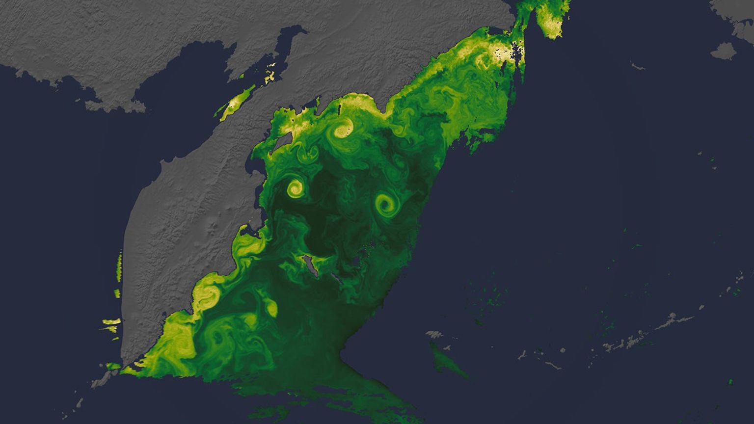
Blooms of tiny plant-like organisms called phytoplankton play essential roles in ocean ecosystems. A key capability of PACE is that it not only spots them from space, but its ocean color observations can identify different types of phytoplankton.
In September 2024, for example, tiny algae were thriving along the coast of Portugal, Spain, and Morocco, while two types of cyanobacteria dominated in the open ocean waters around Madeira and north of the Canary Islands.
-
Some are helpful
Ocean ecologists often sing the praises of diatoms, a relatively large phytoplankton in the center of food webs. When diatoms bloom, fisheries thrive.
Diatoms also play a key role in the global carbon cycle. They produce oxygen and transform carbon dioxide into sugars that feed the marine food web. Diatoms can sink to the ocean depths when they die, effectively capturing carbon absorbed from the atmosphere.
-
Some are harmful
Some species of phytoplankton can be deadly, especially in large numbers. In waters off South Australia, a massive bloom of the algae called Karenia began forming in March 2025, producing neurotoxins that can kill marine life and sicken beachgoers.
Researchers used PACE satellite data to track the bloom for months, picking up its characteristic fluorescence expanding from a few pixels to a region-wide bloom, impacting fishing, tourism, and other businesses.
-
Silver linings
For some scientists sifting through PACE data, clouds block the view; for others, the clouds arethe view. Polarimeters on PACE measure the sunlight bouncing off cloud droplets in the atmosphere, taking observations from multiple angles to provide a unique kind of depth perception.
With the help of machine learning, PACE scientists can reconstruct a 3D portrait of the clouds. It’s a new way of using satellite imagery that could provide insights into how clouds and precipitation form.
-
Ship tracks
In some PACE images of the ocean, streaks of brighter clouds indicate the path of ships below. With few sources of pollution in the open ocean, exhaust from ships changes the nature of the clouds formed. These “ship tracks” comprise smaller cloud droplets than typical marine clouds.
By Kate Ramsayer
NASA’s Goddard Space Flight Center, Greenbelt, Md.
Explore More
Keep Exploring